
Graubünden (Grisons) Canton
Introduction
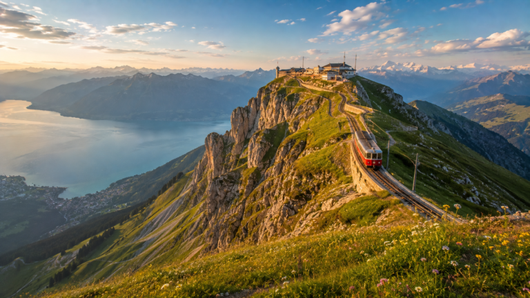
In southeastern Switzerland, where towering Alpine peaks rise above deep valleys and traditional villages cling to mountainsides, Graubünden (Grisons) Canton reveals a distinctive side of the Swiss experience. It is the country’s largest canton by area, yet its population is spread across a remarkable variety of landscapes, from the high Engadin valley to Italian-speaking valleys near the southern border. Its character is shaped by dramatic scenery, historic settlements, regional traditions, and a cultural diversity rarely found in a single Swiss canton.
Graubünden is also Switzerland’s only canton with three official languages: German, Romansh, and Italian. Each language reflects a different historical and cultural influence, giving the region a particularly rich identity. The canton’s capital, Chur, combines a historic old town with modern transport connections, while internationally known destinations such as St. Moritz and Davos attract visitors for winter sports, mountain scenery, wellness, and year-round outdoor activities.
For travelers, there is no single way to experience Graubünden. You can cross spectacular Alpine passes aboard historic trains, hike beside turquoise lakes, explore medieval streets, taste regional specialties, or discover quieter villages where local languages and traditions remain part of everyday life. This Graubünden travel guide explores the canton’s history, major attractions, outdoor adventures, food, transportation, and practical advice to help you plan a memorable visit.
Quick Facts About Graubünden
| Fact | Information |
|---|---|
| Official name | Kanton Graubünden / Cantone dei Grigioni / Chantun Grischun |
| English name | Canton of Grisons |
| Capital | Chur (Coira in Italian; Cuira in Romansh) |
| Largest city | Chur |
| Area | Approximately 7,105 km² |
| Population | 207,400 permanent residents at the end of 2025 |
| Official languages | German, Romansh, Italian |
| Highest point | Piz Bernina, 4,049 m |
| Lowest point | Approximately 260 m, at the Ticino border |
| Joined the Swiss Confederation | 1803, as a full canton |
| Vehicle registration code | GR |
| Municipalities | Check the current cantonal directory; mergers can change the total |
The population figure is the definitive year-end 2025 result published by the cantonal government. Area and geographic figures are based on official cantonal information.
Where Is Graubünden Located?
Graubünden occupies the southeastern corner of Switzerland and covers roughly one-sixth of the country’s territory. Its position among the Alps has historically made it an important region for mountain passes, trade, and connections between northern and southern Europe.
The canton borders the Swiss cantons of Ticino, Uri, Glarus, and St. Gallen. Across the national borders, it meets Italy, Austria, and Liechtenstein. These neighboring regions help explain why Graubünden’s languages, architecture, cuisine, and traditions differ significantly from valley to valley.
For visitors, this location makes Graubünden an excellent destination for combining Swiss Alpine travel with journeys into northern Italy. The Bernina railway corridor, for example, connects the mountain landscapes around St. Moritz and Pontresina with Tirano in Italy.
Geography and Landscape

Graubünden is a mountainous region of high passes, glacial landscapes, forested slopes, river valleys, and clear Alpine lakes. The cantonal government describes it as a land of approximately 150 valleys and hundreds of lakes and mountain peaks. Around 90% of its land lies above 1,200 metres, helping explain why altitude has such a strong influence on settlement, agriculture, transport, and tourism.
Mountains and Alpine Passes
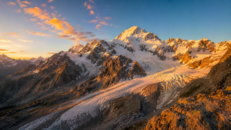
The highest summit is Piz Bernina, reaching 4,049 metres. The Bernina massif dominates the southeastern Alpine landscape, where glaciers, rocky ridges, and high mountain lakes create some of the canton’s most striking scenery.
Mountain passes have also shaped the region’s history. Long before modern roads and railways, routes through the Alps connected communities and facilitated trade. Today, many of these corridors remain important for sightseeing, hiking, cycling, and rail travel.
Lakes and Valleys
The Engadin is one of the best-known Alpine valleys, celebrated for its broad mountain scenery, traditional villages, and lakes around St. Moritz and Sils. Further south, Valposchiavo has a distinctly Italian-influenced atmosphere, while the Rhine Gorge near Flims and Ilanz offers pale limestone cliffs, wooded slopes, and dramatic river scenery.
These valleys are not simply picturesque backdrops. Their different elevations and climates influence local farming, building styles, languages, and seasonal activities.
Rivers and Nature
Graubünden’s waters flow toward three different seas. The Rhine ultimately reaches the North Sea, the Inn flows into the Danube system and the Black Sea, and rivers draining the southern valleys reach the Adriatic. This unusual drainage pattern reflects the canton’s position across the Alpine watershed.
History of Graubünden
Early Settlement and Roman Influence
The territory of modern Graubünden has been inhabited since prehistoric times. The Romans incorporated the region into their Alpine territories shortly before the beginning of the Common Era, recognizing the strategic importance of its passes. Roman administration, Christianity, and Latin-derived linguistic traditions left a lasting mark, particularly in the development of Romansh.
Chur emerged as an important regional centre and became a bishopric in the fifth century. Its long history helps explain why the city remains a cultural and administrative hub today.
The Three Leagues
During the medieval period, local communities, ecclesiastical institutions, and towns formed alliances to defend their rights and maintain control over important routes. Three major political leagues eventually emerged: the League of God’s House, the Grey League, and the League of the Ten Jurisdictions.
Their cooperation developed into the Free State of the Three Leagues, a political structure in which local communities retained considerable autonomy. An agreement in 1524 provided a common framework for the three leagues, marking a significant stage in the region’s political development.
Becoming a Swiss Canton
Graubünden’s relationship with the Swiss Confederation developed over centuries. It did not become a full Swiss canton at the same time as the original members of the Confederation. Following the upheavals of the French Revolutionary and Napoleonic eras, Graubünden formally joined as a canton on 10 March 1803 under the Act of Mediation.
The region subsequently developed within the Swiss federal system while retaining its distinctive local identities and linguistic diversity.
Modern Development
Railways, roads, hotels, and mountain resorts transformed Graubünden during the nineteenth and twentieth centuries. Better transport connections opened remote valleys to visitors, while winter sports helped establish destinations such as St. Moritz and Davos internationally.
Today, tourism remains an important economic activity, alongside agriculture, energy, services, and other regional industries. The challenge is to maintain livelihoods and accessibility while protecting the natural landscapes that make the canton attractive.
Culture and Traditions

Graubünden’s cultural identity is best understood as a collection of regional traditions rather than a single uniform culture. German-speaking communities, Romansh-speaking villages, and Italian-speaking southern valleys each contribute their own customs and artistic influences.
Three Official Languages
German, Romansh, and Italian are the canton’s official languages. Romansh is particularly significant because it is a national minority language spoken in Switzerland and has several regional written and spoken varieties, including Sursilvan, Sutsilvan, Surmiran, Puter, and Vallader.
Visitors may notice differences in place names, public signs, menus, and local expressions as they travel from one valley to another. Romansh is more than a historical curiosity: it remains an important part of regional identity, although its position requires ongoing support and preservation.
Architecture and Local Traditions
Traditional Engadin houses are notable for their thick walls, small windows, and decorative painted or sgraffito façades. In other parts of the canton, villages feature wooden farm buildings, stone churches, and settlements adapted to steep slopes and long winters.
Local festivals, music, community celebrations, and seasonal agricultural traditions vary between regions. To experience this diversity, spend time in smaller villages rather than limiting a trip to the best-known resorts.
Major Cities and Towns
1. Chur — The Historic Capital
Chur is the capital and largest city of Graubünden and one of Switzerland’s oldest urban settlements. Its compact old town, cathedral precinct, museums, cafés, and historic streets make it an excellent starting point for exploring the canton. The city also serves as an important railway gateway to the Alpine regions.
2. St. Moritz — Alpine Elegance
Located in the Upper Engadin, St. Moritz is internationally known for winter sports, upscale hotels, wellness, and its lake setting. It is also a practical base for mountain excursions and scenic rail journeys. Summer brings hiking, cycling, and lake activities beyond the winter resort atmosphere.
3. Davos — Mountain Recreation
Davos combines a high-altitude town with extensive outdoor opportunities. In winter, visitors come for skiing and snowboarding; in warmer months, hiking and mountain biking become major attractions. The town also has an international profile through conferences and events.
4. Pontresina — A Gateway to the High Alps
Pontresina is a mountain village close to the Bernina massif and the Morteratsch Glacier area. It appeals to hikers, mountaineers, and travelers looking for an Alpine base with access to high mountain scenery.
5. Scuol — Lower Engadin Character
Scuol offers traditional Engadin architecture, access to mountain trails, and a strong connection to Romansh culture. Its thermal bathing tradition and surrounding landscapes make it a rewarding choice for travelers seeking a quieter alternative to the major resorts.
6. Poschiavo — Italian-Speaking Alpine Heritage
Poschiavo lies in a southern valley with Italian-language traditions, historic buildings, and a distinctive culinary culture. It is an excellent stop for travelers exploring the Bernina railway route and the landscapes south of the high Alpine pass.
Top Attractions in Graubünden

1. The Rhaetian Railway and Landwasser Viaduct
The railway is one of Graubünden’s most celebrated attractions. The Albula and Bernina lines form a UNESCO World Heritage property recognized for their engineering, architectural quality, and integration into the Alpine landscape. The Landwasser Viaduct, with its curved stone structure leading directly toward a mountainside tunnel, is one of the route’s signature landmarks.
The World Heritage property was inscribed in 2008. Traveling by train lets visitors experience the combination of tunnels, bridges, mountain passes, and changing landscapes that made the railway an engineering achievement.
2. The Bernina Express
The Bernina Express is a panoramic rail journey through the Alps between the Chur or St. Moritz area and Tirano in Italy. The route passes glacial landscapes, high mountain lakes, dramatic viaducts, and the Bernina Pass before descending toward the Italian-speaking southern valleys.
It is particularly suitable for visitors who want to enjoy spectacular scenery without undertaking a strenuous hike. Check the official timetable and seat-reservation requirements before travel, as services and operating arrangements vary by season.
3. Swiss National Park
Located in the eastern part of Graubünden, the Swiss National Park protects a large Alpine natural environment. Its marked hiking trails provide opportunities to observe wildlife and learn about mountain ecosystems, with possibilities for seeing ibex, chamois, marmots, and other native animals.
The park is a protected natural area, not a conventional recreational playground. Visitors must follow its conservation rules, stay on permitted routes, and check trail conditions before setting out. The official park guidance notes that the hiking season generally runs from mid-May to mid-November, depending on altitude and weather.
4. Rhine Gorge (Ruinaulta)
The Rhine Gorge, often called the Grand Canyon of Switzerland, was formed following a massive prehistoric landslide. Today, the Vorderrhein flows between striking pale cliffs, forests, and gravel banks. Viewpoints, hiking routes, cycling opportunities, and railway journeys allow visitors to appreciate the landscape from different perspectives.
The gorge is an excellent destination for nature photography and outdoor excursions. The viewpoint at il Spir, near Flims, is especially popular for its elevated perspective across the canyon.
5. St. Moritz and the Upper Engadin Lakes
St. Moritz is a destination in its own right, but the surrounding Upper Engadin is equally rewarding. Lakes such as Lake Sils and Lake Silvaplana create broad reflective landscapes framed by mountain ranges. In summer, visitors can walk or cycle along the shorelines; wind conditions around Lake Silvaplana also attract watersports enthusiasts.
The area’s appeal extends beyond luxury tourism. Traditional villages, hiking trails, and mountain transport connections make the Upper Engadin a versatile destination for different budgets and interests.
6. Swiss Tectonic Arena Sardona
The Swiss Tectonic Arena Sardona is a UNESCO World Heritage area recognized for the exceptional visibility of geological processes that helped form the Alps. The landscape provides a rare opportunity to understand how older rock layers were pushed over younger ones during mountain building.
It is particularly interesting for geology enthusiasts, hikers, and visitors who want to understand the science behind the Alpine scenery rather than simply admire its appearance.
7. Chur Old Town and Cathedral
Chur offers a more urban historical experience than the mountain resorts. Its old town contains narrow streets, historic buildings, and the cathedral precinct, providing an accessible introduction to the canton’s long history. Allow time to explore on foot, visit local museums, and enjoy a meal before continuing into the mountains.
8. Lake Cauma
Near Flims, Lake Cauma is known for its vivid turquoise-green water and forested surroundings. It is a popular warm-season destination for lakeside walks, photography, and swimming where permitted. Because access, facilities, and visitor arrangements may vary seasonally, check local information before visiting.
Nature and Outdoor Activities

Outdoor recreation is one of the strongest reasons to visit Graubünden. The canton’s varied elevations, extensive mountain terrain, and established resort infrastructure support activities in every season.
- Hiking: Explore the Engadin, the Rhine Gorge, the Bernina region, and marked routes around the Swiss National Park. Choose routes appropriate to your fitness and experience.
- Cycling and mountain biking: Mountain roads, valley routes, and designated trails offer options ranging from relaxed rides to demanding climbs.
- Skiing and snowboarding: Resorts around Davos-Klosters, St. Moritz, and other mountain destinations offer winter sports, subject to snow and operating conditions.
- Water sports: Lakes around the Engadin provide opportunities for sailing, windsurfing, and other seasonal activities. Swimming is possible at selected lakes.
- Wildlife watching: Protected natural areas and mountain valleys offer opportunities to observe Alpine wildlife. Keep a respectful distance and follow local rules.
- Scenic train journeys: The Albula and Bernina routes make it possible to experience remarkable Alpine scenery without strenuous physical activity.
Mountain weather can change quickly. Before hiking, check forecasts, trail closures, transport schedules, and the difficulty of the planned route. Snow and ice can persist at high elevations after conditions have improved in the valleys.
Food and Local Specialties

Graubünden’s cuisine reflects Alpine farming, preserved foods, regional ingredients, and influences from its German-, Romansh-, and Italian-speaking communities.
Capuns
Capuns are a well-known regional dish made by wrapping a savory filling in Swiss chard leaves. Recipes commonly include dough, herbs, regional sausage, and Bündnerfleisch, with variations between households and localities. The rolls are often served with a creamy sauce or cheese.
Bündner Nusstorte
This rich walnut tart is one of the canton’s best-known sweet specialties. Its pastry shell contains a caramelized walnut filling, making it an excellent choice to accompany coffee or tea. It is also a popular edible souvenir.
Bündnerfleisch
Bündnerfleisch is air-dried beef associated with the region. It is commonly served in thin slices, often as part of a platter with local cheese and bread.
Pizzoccheri
Pizzoccheri, buckwheat-based ribbon pasta traditionally prepared with potatoes, vegetables, cheese, butter, garlic, and sage, is especially associated with the Italian-speaking Valposchiavo region. Its ingredients reflect the culinary connections between southern Graubünden and neighboring Alpine areas of Italy.
For a more complete food experience, try regional cheeses, local breads, dried meats, and seasonal dishes in family-run restaurants and village inns. Ask about regional specialties rather than assuming that every restaurant serves the same traditional menu.
Economy and Industry
Tourism is a major pillar of the Graubünden economy. Hotels, restaurants, mountain railways, ski areas, wellness facilities, and outdoor recreation businesses support employment in destinations such as Davos, St. Moritz, and the Engadin.
Agriculture remains important in rural valleys, particularly livestock farming and Alpine pasture management. The canton also benefits from hydropower, construction, retail, healthcare, public services, and other businesses that support residents and visitors.
Its transport infrastructure has economic importance beyond tourism: roads and railways connect otherwise separated valleys, help local communities access services, and link Switzerland with neighboring countries. Balancing tourism development, housing needs, employment, and environmental protection remains an important regional challenge.
Transportation and Getting Around
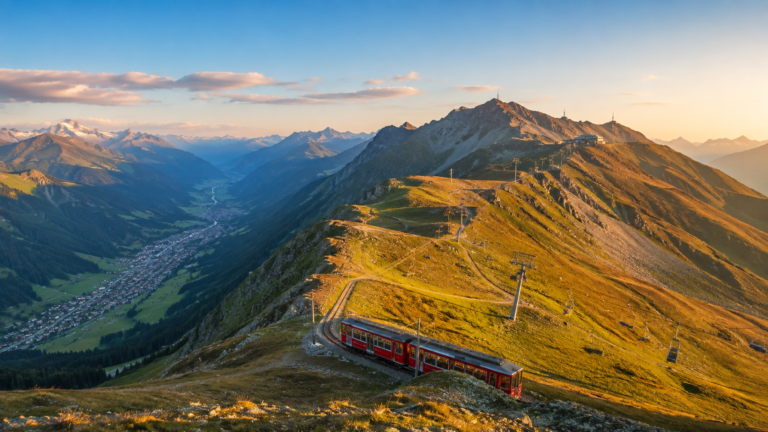
Rail travel is one of the best ways to explore Graubünden. The national rail network connects major Swiss cities with Chur, while the Rhaetian Railway provides extensive connections across the canton, including routes toward Davos, St. Moritz, and the Bernina region. Its network also extends to Tirano in Italy.
Getting There
- By train: Chur is a convenient arrival point from other parts of Switzerland. From there, regional trains connect visitors to many mountain destinations.
- By car: Major roads and the A13 corridor provide access to much of the canton. Mountain passes may be closed or restricted in winter.
- By bus: Regional buses and PostBus services serve communities not directly connected by rail.
- By air: Graubünden has no major international passenger airport comparable to Zurich Airport. Zurich Airport is a common gateway for international visitors, followed by onward rail travel.
Getting Around Within the Canton
Public transportation is often preferable to driving between popular destinations. Mountain railways and cable cars provide access to viewpoints and hiking areas, but schedules and operating seasons vary.
Consider booking panoramic train reservations early during busy periods. Check official timetables before setting out, particularly if your plans depend on making a connection or returning from a remote valley.
Best Time to Visit Graubünden

Spring — April to June
Spring brings longer days and the gradual return of green landscapes at lower elevations. It is a good time for town visits, photography, and quieter sightseeing, although higher trails may still have snow and some mountain facilities may not yet be operating.

Summer — June to September
Summer is ideal for hiking, cycling, lakeside activities, mountain excursions, and scenic rail journeys. Many high-altitude routes and seasonal facilities become accessible, depending on snow conditions and the weather.

Autumn — September to November
Golden larch forests and quieter mountain towns make autumn especially attractive for photography and relaxed sightseeing. As temperatures fall, higher trails and some mountain facilities close for the season.

Winter — December to March
Winter is the main season for skiing, snowboarding, snowshoeing, and snowy Alpine scenery. St. Moritz and Davos are prominent destinations, but popular accommodation and activities can be expensive during peak dates.
The best time to visit depends on your priorities. Choose summer for extensive hiking and lake activities, winter for snow sports, or autumn for changing foliage and a quieter atmosphere. These are broad seasonal guides, not guarantees of particular weather or trail conditions.
Travel Tips for Visitors
- Currency: Switzerland uses the Swiss franc (CHF). Cards are widely accepted, although a small amount of cash can be useful in some rural settings.
- Languages: German, Romansh, and Italian are official languages. English is often understood in tourist areas, but not everywhere.
- Transport: Compare train and regional transport options before renting a car. For multi-stop journeys, check whether a Swiss Travel Pass or a regional ticket offers value for your itinerary.
- Altitude: Bring layers, sun protection, and suitable footwear. Temperatures can be much lower in the mountains than in Chur.
- Reservations: Book accommodation and popular panoramic train journeys ahead during peak holiday periods.
- Respect nature: Follow marked trails, observe protected-area rules, and take your rubbish with you.
- Local etiquette: Be considerate in residential villages, follow posted rules, and ask permission before photographing people closely.
- Costs: St. Moritz and some other resort destinations can be expensive. Smaller towns, guesthouses, and carefully planned public transport may help control costs.
- Mountain safety: Check current weather and trail conditions, especially if hiking in remote terrain or above the tree line.
Interesting Facts About Graubünden
- Switzerland’s largest canton: Graubünden covers approximately 7,105 km², making it the country’s largest canton by area.
- Three official languages: German, Romansh, and Italian are all official languages of the canton.
- A capital with ancient roots: Chur is one of Switzerland’s oldest urban settlements and has a long history as a regional centre.
- A 4,000-metre summit: Piz Bernina rises to 4,049 metres, making it the highest mountain in Graubünden.
- A UNESCO railway: The Albula and Bernina railway lines were inscribed on the UNESCO World Heritage List in 2008.
- A landscape shaped by geology: The Rhine Gorge developed following a major prehistoric landslide and is now one of the region’s most distinctive natural attractions.
- A remarkable Alpine watershed: Rivers originating in the canton eventually flow toward the North Sea, the Black Sea, and the Adriatic.
- An important protected landscape: The Swiss National Park offers marked hiking trails and opportunities to learn about Alpine ecology, with strict conservation rules.
- A historic political union: The Three Leagues formed the basis of the political structure that preceded the modern canton.
- An international rail journey: The Bernina Express links Swiss Alpine landscapes with Tirano in Italy.
Why Visit Graubünden?
Graubünden is an excellent choice for travelers who want more than a single famous Swiss viewpoint. Its combination of dramatic mountains, historic towns, regional languages, protected natural areas, and remarkable railway journeys offers a varied experience of the country.
The canton suits hikers, skiers, photographers, railway enthusiasts, families, and travelers interested in local food and cultural heritage. First-time visitors can focus on Chur, St. Moritz, and the Bernina Express, while returning travelers may prefer smaller villages, the Italian-speaking valleys, or longer hiking itineraries.
Its greatest appeal lies in the contrasts between destinations. A day can begin in a historic town, continue through high Alpine scenery, and end in a village where the language and cuisine feel distinctly different. That diversity makes Graubünden particularly rewarding for a multi-day journey.
Frequently Asked Questions
1. What is Graubünden famous for?
Graubünden is famous for its Alpine landscapes, St. Moritz, Davos, the Bernina Express, the Landwasser Viaduct, the Swiss National Park, traditional villages, and its three official languages.
2. What is the capital of Graubünden?
Chur is the capital and largest city of Graubünden. It is an important transport hub and a convenient base for exploring the canton.
3. What languages are spoken in Graubünden?
The canton has three official languages: German, Romansh, and Italian. The language most commonly encountered varies by region, with Romansh particularly important in parts of the Engadin and Surselva.
4. What is the best time to visit Graubünden?
Summer is excellent for hiking, cycling, lakes, and scenic rail journeys. Winter is best for skiing and snowboarding, while autumn offers colorful Alpine landscapes. Spring is often suitable for lower-altitude sightseeing, although mountain access can be limited.
5. How many days should I spend in Graubünden?
Allow at least three to five days to experience a few major highlights without rushing. A week or longer provides more time to explore multiple valleys, smaller villages, mountain trails, and the Bernina railway route.