
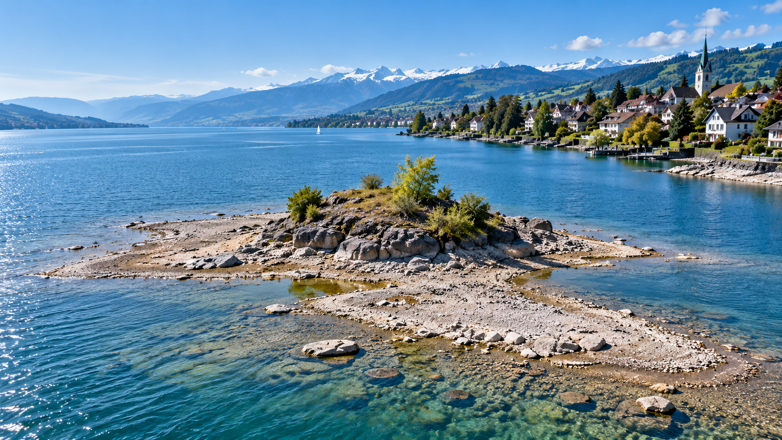
Lake Zurich Drought Exposes Rare Island as Switzerland Faces Persistent Water Shortages
A small island has emerged from the waters of Lake Zurich for the first time in decades, offering a striking visual reminder of the severe drought conditions affecting large parts of Switzerland.
The newly exposed land formation has appeared near the municipality of Stäfa on the eastern shore of the lake after water levels dropped to unusually low levels following months of limited rainfall and exceptionally dry conditions. What is normally visible as a single rock formation known locally as the Stäfner Stein has expanded into a small island large enough for visitors to reach by boat.
The development comes as Swiss authorities continue to monitor one of the most significant drought episodes in recent years, with rivers, lakes, and groundwater reserves across the country showing signs of prolonged water stress.
According to hydrological data and regional authorities, Lake Zurich’s water level has remained far below seasonal norms following a summer marked by unusually low precipitation and persistent dry weather. Recent measurements placed the lake at around 405.24 meters above sea level, a level associated with historic low-water events.
The appearance of the island is not entirely unprecedented. Historical records indicate that similar conditions revealed the same land formation during previous periods of extreme low water. The island was reportedly visible during a major low-water event in the early 1950s and before that during exceptionally dry conditions in 1909. A historic marker indicating the earlier water level has also become visible once again after remaining submerged for many years.
While the newly exposed island has attracted curiosity among residents and visitors, environmental experts view the phenomenon as part of a broader hydrological challenge rather than a tourist attraction alone.
Across Switzerland, drought conditions have affected waterways, ecosystems, navigation, agriculture, and local water management. Federal drought monitoring systems continue to classify the Lake Zurich region as facing a high drought risk, reflecting ongoing concerns about water availability and environmental impacts.
Authorities have already implemented measures intended to slow the decline in lake levels. In late September, officials in Zurich, working with neighboring cantons and federal environmental authorities, decided to temporarily reduce water outflow from Lake Zurich. The measure was designed to preserve water levels and minimize disruptions to ferry services, lake navigation, and emergency rescue operations.
The decision highlights the balancing act facing water managers. Retaining more water in the lake helps protect transportation and public safety activities but can reduce downstream river flows, affecting ecosystems and hydroelectric power generation. Officials have acknowledged that the continuing drought has forced difficult choices regarding water distribution and environmental management.
The situation at Lake Zurich is part of a larger national pattern. Throughout 2026, several Swiss lakes and rivers recorded exceptionally low water levels. Scientists and environmental agencies have described the summer as one of the driest and hottest periods in recent decades, with rainfall significantly below long-term averages in many regions.
The drought has produced visible consequences beyond Lake Zurich. Some rivers have approached record-low levels, while navigation routes and ferry services have faced restrictions. In other parts of the country, shrinking waterways have altered landscapes and revealed previously submerged features. Reports from recent weeks also noted that low river levels had temporarily connected islands to the mainland in certain locations.
Climate researchers caution that isolated events such as the appearance of a temporary island should be viewed within a broader context of changing weather patterns and increasing hydrological variability. While no single drought can be directly attributed to long-term climate change without detailed scientific analysis, experts have repeatedly warned that warmer temperatures can intensify evaporation and increase the likelihood of prolonged dry periods.
For communities surrounding Lake Zurich, the immediate concern remains water management rather than the island itself. Local authorities continue to monitor forecasts closely, searching for signs that substantial rainfall could help stabilize water levels before winter.
Current outlooks, however, offer little indication of a rapid recovery. Officials have stated that inflows into the lake remain lower than outflows, even after emergency measures were introduced. Weather forecasts have not pointed to prolonged periods of heavy rain capable of quickly restoring normal conditions.
As a result, the newly emerged island may remain visible for some time, becoming an unusual symbol of Switzerland’s drought challenges in 2026.
What appears at first glance to be an unexpected geographic curiosity ultimately reflects a much larger environmental story. The exposed island near Stäfa serves as a reminder that even a country often associated with abundant water resources is not immune to the consequences of prolonged dry weather. Whether the island disappears again in the coming months will depend largely on rainfall, water management decisions, and the evolution of drought conditions across the region.